3.15.030 Provisions for new or rehabilitated landscapes.
A. Submittal and Approval of a Landscape Documentation Package.
1. Prior to construction, the project applicant shall:
a. Submit two copies of a landscape documentation package to the Coachella Valley Water District (district) that conform to this chapter. No water meter will be issued until the district reviews and approves the landscape documentation package.
b. Submit one copy of the landscape documentation package to the local agency (city/county).
2. Upon receipt of the landscape documentation package, the district shall:
a. Review the landscape documentation package.
b. Approve or deny the landscape documentation package.
3. Upon approval of the landscape documentation package, the district will:
a. Sign and date the approved plans and return them to the project applicant.
b. Submit a copy of the project’s water efficient landscape worksheet (Appendix B of this chapter) to the local agency.
4. Upon approval of the landscape documentation package by the local agency, the project applicant shall:
a. Receive an approval of the landscape design review or plan check.
b. Finalize the certificate of completion, including recording the date of the approval.
c. File the certificate of completion with the district and the local agency, and provide a copy to the property owner or designee.
d. Submit a copy of the approved landscape documentation package, along with the record drawings and any other information, to the property owner or designee.
5. Each landscape documentation package shall include the following elements:
a. A completed landscape documentation package checklist (Appendix A of this chapter), which includes the date, project applicant, and project address information. This checklist serves to verify that the elements of the landscape documentation package have been completed.
b. Total landscaped area (square feet).
c. Project type (e.g., new, rehabilitated, public, private, cemetery, homeowner-installed, etc.).
d. Water efficient landscape worksheet (Appendix B of this chapter), which may be imbedded in the plan sheets of the landscape documentation package, and include the following:
i. Hydrozone information table (reference Appendix C of this chapter).
e. Water budget calculations (reference Appendix D of this chapter) that adhere to the following requirements:
i. The plant factor used shall be from WUCOLS. The plant factors range from 0 to 0.3 for the low use plants, from 0.4 to 0.6 for the moderate use plants, from 0.7 to 1.0 for the high use plants and 1.1 to 1.2 for water features.
ii. All water features shall be included in the 1.1 to 1.2 hydrozone and temporary irrigated areas shall be included in the low water use hydrozone. For the calculation of the maximum applied water allowance (MAWA) and estimated total water use, a project applicant shall use ETo values from the reference evapotranspiration table, Appendix C of this chapter. For geographic areas not covered in Appendix C of this chapter, use data from other cities located nearby in the same reference evapotranspiration zone.
f. Landscape design plan.
g. Irrigation design plan.
h. Grading design plan (as required).
i. Soil management report (as required).
j. All plans must contain a signature block for both the local agency and the district.
6. The landscape documentation package shall be submitted by the following procedure:
a. The applicant or applicant’s representative may bring, send or ship copies of the landscape documentation package to the district, and the local agency, as applicable. Appropriate fees must accompany the landscape documentation package.
b. The plans will normally be returned to the applicant or local agency with comments by the district (water management department) within 10 working days of receipt.
c. After noted corrections have been made, the applicant shall resubmit the landscape documentation package to the district for approval and signing by the water management department and development services department for the district.
d. Signed plans will be held at the district’s Palm Desert office for applicant pickup or sent by certified shipping at the applicant’s request and expense.
e. For direct communication:
|
Telephone No.: |
(760) 398-2651 Water Management Department |
|
Mailing Address: |
Coachella Valley Water District Attention: Water Management Department Post Office Box 1058 Coachella, California 92236 |
|
Hand Delivery or Shipping Address: |
Coachella Valley Water District Attention: Water Management Department 85-995 Avenue 52 Coachella, California 92236 |
|
Hand Delivery or Shipping Address: |
Coachella Valley Water District Attention: Water Management Department 75-525 Hovley Lane East Palm Desert, California 92211 |
f. The district will inspect the landscaped area(s) for conformance with the approved landscape documentation package. Landscaping that does not conform to the approved landscape documentation package is subject to penalties as provided in CVWDC 3.15.070.
7. Upon review and approval of the landscape documentation package by the district, the project applicant shall:
a. Submit a copy of the district-approved landscape documentation package and water efficient landscape worksheet to the local agency.
b. Provide the property owner or site manager a copy of the district approved landscape documentation package, in addition to the record drawings and any other information normally forwarded to the property owner or site manager.
8. Upon review and approval of the landscape documentation package by the local agency, the project applicant shall:
a. Record the date of the permit on the certificate of completion.
b. Provide the property owner or designee a copy of the local agency approved landscape documentation package, in addition to the record drawings, and any other information normally forwarded to the property owner or designee.
B. Landscape Design Plan. A landscape design plan meeting the following design criteria shall be submitted as part of the landscape documentation package. For the efficient use of water, a landscape shall be carefully designed and planned for the intended function of the project.
1. Any plant may be selected for the landscape, providing the estimated total water use in the landscape area does not exceed the maximum applied water allowance (MAWA). To encourage the efficient use of water the following is highly recommended:
a. Protection and preservation of native species and natural vegetation;
b. Selection of water-conserving plant and turf species;
c. Selection of trees based on applicable local tree ordinances or tree shading guidelines; and
d. Selection of plants from local and regional landscape program plant lists.
2. Specifications for Landscape Design Plan. The landscape design plan shall be drawn on 36-inch by 24-inch project base sheets at a scale that accurately and clearly identifies the following:
a. Tract name, tract number or parcel map number on cover sheet.
b. Proposed planting areas.
c. Plant material location and size.
d. Plant botanical and common names.
e. Plant spacing, where applicable.
f. Natural features including, but not limited to, rock outcroppings and existing trees and shrubs that will remain incorporated into the new landscape.
g. Vicinity map showing site location on top sheet or on cover sheet.
h. Title block on each sheet with the name and address of the project, and the name and address of the professional design company with its signed professional stamp, if applicable.
i. Reserve two six-inch by three-inch spaces for (i) the local agency signature block and (ii) a district signature block in lower right corner of the cover sheet and on all of the landscape, irrigation design/detail/specification sheets. The district signature block can be found on the Professional Landscaper section of the Conservation page at cvwd.org.
j. Show plan scale and north arrow on design sheets.
k. Show graphic scale on all design sheets.
l. Show all property lines and street names.
m. Show all paved areas, such as driveways, walkways and streets.
n. Show all pools, ponds, lakes, fountains, water features, fences and retaining walls.
o. Show locations of all overhead and underground utilities within project area.
p. Provide an index map, as necessary, showing the overall project, including all 1/4 and 1/16 section lines and section numbers.
q. Show this note on each design sheet stating, “No permanent structures or trees within CVWD and/or USBR easements. CVWD will not be responsible for damage or replacement of any surface improvements, including but not limited to, decorative concrete, landscaping, curb, gutter, sidewalks, planters, gates and related improvements installed within CVWD and/or USBR easements.”
In addition, no trees shall be installed within 15 feet of a CVWD and/or USBR pipeline. Surface improvements may be installed within CVWD and/or USBR easements only upon the prior consent of CVWD, which consent may be granted or denied at CVWD’s sole discretion. In the event of such consent, then a noninterference review letter (NIRL) may apply per Section 3.4 of CVWD’s Development Design Manual.
r. Show maximum applied water allowance (MAWA) for the proposed project. (See formula in Appendix C of this chapter and sample MAWA, Appendix D of this chapter.)
s. Show total landscaped area in square feet. Separate area square footages by hydrozone. Show the total percentage area of each hydrozone. Include total area of all water features as separate hydrozones of still or moving water. Show estimated total water use for each major plant group hydrozone and water feature hydrozone expressed in either seasonal (turf grass) or annual (trees, shrubs, groundcovers and water features) billing units.
t. Show total estimated water use for each major plant group hydrozone and water feature hydrozone expressed in either seasonal (turf grass) or annual (trees, shrubs, groundcovers and water features) billing units.
u. Show total estimated water use (ETWU) for the entire project. (Formula in Appendix C and on Sample Calculation Estimated Water Use, Appendix D.) The total estimated use shall not exceed the maximum applied water allowance (MAWA).
The estimated total water use (ETWU) for a phase within a tract may exceed the maximum applied water allowance for that phase so long as the ETWU does not exceed the MAWA within the overall tract. In the event this occurs calculations showing all phase totals should be imbedded within each plan submission for the tract.
v. Designate recreational areas and recreational turf areas.
w. When model homes are included, show the maximum applied water allowance (MAWA) and estimated total water use (by hydrozone with totals) for each model unit.
3. Landscape Design Criteria.
a. The landscape design must be carefully planned and take into account the intended function of the project.
b. Plants’ appropriateness shall be selected based upon their adaptability to the climatic, geologic and topographical conditions of the site.
c. Selection of water-efficient and low-maintenance plant material is required.
d. All planted areas must be a minimum of one inch below adjacent hardscapes to eliminate runoff and overflow.
e. Long, narrow or irregularly shaped turf areas shall not be designed because of the difficulty in irrigating uniformly without overspray onto hardscaped areas, streets and sidewalks. Areas less than 10 feet in width shall not be designed with turf. Turf will be allowed in these areas only if irrigation design reflects the use of subsurface irrigation or a surface flow/wick irrigation system.
f. Turf areas irrigated with spray/rotor systems must be set back at least 24 inches from curbs, driveways, sidewalks or any other area that may result in runoff of water onto streets. An undulating landscape buffer area created by the setback shall be designed with rocks, cobble or decomposed granite and/or can be landscaped with drip irrigated shrubs/accents or covered with a suitable groundcover.
g. Plants having similar water use shall be grouped together in distinct hydrozones.
h. The use of a soil covering mulch or a mineral groundcover of a minimum three-inch depth to reduce soil surface evaporation is required around trees, shrubs and on nonirrigated areas. The use of boulders and cobble shall be considered to reduce the total vegetation area.
i. Annual color plantings shall be used only in areas of high visual impact and must be irrigated with drip, microirrigation or other systems with efficiencies of 90 percent or greater. Otherwise, drip irrigated, perennial plantings should be the primary source of color.
j. Native desert plants shall be specified to be planted in a shallow, wide, rough hole two times the root ball width. The root ball will be set on either undisturbed native soil or a firmed native soil. The root ball top will be set even with the finished surface grade or above grade if the soil is poorly drained. The hole must be backfilled with native soil. Extra soil may be used to mound up around plants where the soil is poorly drained.
k. Landscaping must not obstruct or interfere with street signs, lights or road/walkway visibility. Screening may be provided by walls, berms or plantings.
l. High water use plants, characterized by a plant factor of 0.7 to 1.0, are prohibited in street medians.
m. Use locally approved plant materials lists in the selection of appropriate plants.
n. Planter islands in parking lots with canopy trees shall be sized to meet local land use agency requirements.
o. A landscape plan in fire-prone areas shall address fire safety and prevention. A defensible space or zone around a building or structure is required per California Public Resources Code Sections 4291(a) and (b). Avoid fire-prone plant material and highly flammable mulches.
p. The use of invasive and/or noxious plant species is prohibited.
q. The architectural guidelines of a common interest development, which includes community apartment projects, condominiums, planned developments and stock cooperatives, shall not prohibit or include conditions that have the effect of prohibiting the use of low water use plants as a group (California Civil Code Section 1353.8).
C. Grading Design Plan.
1. For efficient use of water, grading of a project site shall be designed to minimize soil erosion, runoff and water waste. A grading plan shall be submitted as part of the landscape documentation package. A comprehensive grading plan prepared by a civil engineer for other local agency permits satisfies this requirement.
2. The project applicant shall submit a landscape grading plan that indicates finished configurations and elevations of the landscape area including:
a. Height of graded slopes;
b. Drainage patterns;
c. Pad elevations;
d. Finish grade; and
e. Storm water retention improvements, if applicable.
3. To prevent excessive erosion and runoff, it is highly recommended, and per local agency requirements, that project applicants:
a. Grade so that all irrigation and normal rainfall remains within property lines and does not drain on to nonpermeable hardscapes;
b. Avoid disruption of natural drainage patterns and undisturbed soil; and
c. Avoid soil compaction in landscape areas.
4. The grading design plan shall contain the following statement: “I have complied with the criteria of the ordinance and applied them accordingly for the efficient use of water in the grading plan.”
5. Turf is not allowed on slopes greater than 25 percent where the toe of the slope is adjacent to an impermeable hardscape and where 25 percent means one foot of vertical elevation change for every four feet of horizontal length (rise divided by run x 100 = slope percent).
6. Slopes greater than 25 percent shall not be irrigated with an irrigation system with a precipitation rate exceeding 0.75 inches per hour. This restriction may be modified if the landscape designer specifies an alternative design or technology, as part of the landscape documentation package, and clearly demonstrates no runoff or erosion will occur. Prevention of runoff must be confirmed during an irrigation audit.
7. All grading must retain normal storm water runoff and provide for an area of containment. All irrigation water must be retained within property lines and not allowed to flow into public streets or public rights-of-way. Where appropriate, a simulated dry creek bed may be used to convey storm drainage into retention areas. A drywell shall be installed if the retention basin is to be used as a recreational area.
8. Mounded or sloped planting areas that contribute to runoff onto hardscape are prohibited. Sloped planting areas above a hardscaped area shall be avoided unless there is a drainage swale at toe of slope to direct runoff away from hardscape.
9. Median islands must be graded to prevent storm water and excess irrigation runoff.
D. Irrigation Design Plan. For the efficient use of water, an irrigation system shall meet all the requirements listed in this section and the manufacturer’s recommendations. The irrigation system and its related components shall be planned and designed to allow for proper installation, management, and maintenance. An irrigation design plan meeting the following criteria shall be submitted as part of the landscape documentation package.
Separate landscape water meters shall be installed for all projects except single-family homes with a landscape area less than 5,000 square feet. Landscape meters for single-family homes with a landscape area over 5,000 square feet may be served by a permanent service connection provided by the district or be a privately owned submeter installed at the irrigation point of connection on the customer service line. When irrigation water is from a well, the well shall be metered. The irrigation design plan shall be drawn on project base sheets. It should be separate from, but use the same format as, the landscape design plan. The irrigation system specifications shall accurately and clearly identify the following:
1. Specifications for Irrigation Design.
a. Control valves, manufacturer’s model number, size and location.
b. Irrigation head manufacturer’s model number, radius, operating pressure, gallons per minute/gallons per hour (gpm/gph) and location.
c. Piping type, size and location.
d. Point of connection or source of water and static water pressure.
e. Meter location and size (where applicable).
f. Pump station location and pumping capacity (where applicable).
g. Power supply/electrical access and location.
h. Plan scale and north arrow on all sheets.
i. Graphic scaling on all irrigation design sheets.
j. Irrigation installation details and notes/specifications.
k. The irrigation system shall be automatic, constructed to discourage vandalism and simple to maintain.
l. All equipment shall be of proven design with local service available.
m. Show location, station number, size, and design gpm of each valve on plan. Control valves shall be rated at 200 psi.
n. Visible sprinklers near hardscape shall be of pop-up design.
o. All heads should have a minimum number of wearing pieces with an extended life cycle.
p. Sprinklers, drippers, valves, etc., must be operated within manufacturer’s specifications.
q. Manual shut-off valves shall be fully ported ball valves or butterfly valves. Manual shut-off valves are required upstream of automatic valve manifolds.
r. Master valves shall be metal, located as close to the point of connection as possible, and be metal piped between the master valve and the water meter.
s. High flow sensors that detect and report high flow conditions created by system damage or malfunction shall be specified for all projects where a dedicated landscape irrigation meter is required.
t. The following statement: “I have complied with the criteria of the ordinance and have applied them accordingly for the efficient use of water in the irrigation design plan.”
u. The signature of a licensed landscape architect, certified irrigation designer, irrigation consultant, landscape contractor or any other person authorized to design an irrigation system.
2. Specifications for Irrigation Efficiency. The minimum irrigation efficiency shall be 0.75 (75 percent). Greater irrigation efficiencies are expected from well-designed and maintained systems.
The following are required:
a. Design spray head and rotor head stations with consideration for worst wind conditions. Close spacing and low-angle nozzles are required in high and frequent wind areas (ETo Zone No. 5).
b. Spacing of sprinkler heads shall not exceed manufacturer’s maximum recommendations for proper coverage. The plan design shall show a minimum of 0.75 (75 percent) distribution uniformity.
c. Only irrigation heads with matched precipitation rates shall be circuited on the same valve.
d. Valve circuiting shall be designed to be consistent with hydrozones.
e. Individual hydrozones that mix plants that are moderate and low water use may be allowed if:
i. Plant factor calculation is based on the proportions of the respective plant water uses and their plant factor; or
ii. The plant factor of the higher water using plant is used for the calculations.
f. Individual hydrozones that mix high and low water use plants shall not be permitted.
g. On the landscape design plan and irrigation design plan, hydrozone areas shall be designated by number, letter, or other designation. On the irrigation design plan, designate the areas irrigated by each valve, and assign a number to each valve. Use this valve number in the hydrozone information table. This table can assist with preinspection and final inspection of the irrigation system, and programming the controller.
3. Irrigation System Criteria.
a. Reduced pressure backflow prevention devices shall be installed behind meter at curb by the district.
b. Show location, station number, size and design gpm of each valve on plan.
c. Smart controllers shall be specified for all projects. This includes climate based or sensor based controllers, which can automatically adjust for local weather and/or site conditions.
d. High flow check valves shall be installed in or under all heads adjacent to street curbing, parking lots and where damage could occur to property due to flooding, unless controllers with flow sensor capabilities are specified that can automatically shut off individual control valves when excess flow is detected.
e. Pressure compensating screens/devices shall be specified on all spray heads to reduce radius as needed to prevent overthrow onto hardscape and/or to control high pressure misting.
f. All irrigation systems shall be designed to avoid runoff onto hardscape from low head drainage, overspray and other similar conditions where water flows onto adjacent property, nonirrigated areas, walks, roadways or structures.
g. Rotor type heads shall be set back a minimum of four feet from hardscape.
h. The use of drip, microirrigation or pressure compensating bubblers or other systems with efficiencies of 90 percent or greater is required for all shrubs and trees. Small, narrow (less than eight feet), irregularly shaped or sloping areas shall be irrigated with drip, microspray or PC (pressure compensating) bubbler heads.
i. Trees in turf areas shall be on a separate station to provide proper deep watering.
j. Street Median Irrigation.
i. No overhead sprinkler irrigation system shall be installed in median strips or in islands.
ii. Median islands or strips shall be designed with either a drip emitter to each plant or subsurface irrigation. Bubblers used for trees must be fixed-flow pressure compensating type. Adjustable bubblers are prohibited.
k. Meter sizing for landscape purposes shall be 33 gpm per planted acre. Maximum design meter flow rates are: three-fourths inch = 23 gpm, one inch = 37 gpm, one and one-half inches = 80 gpm, two inches = 120 gpm.
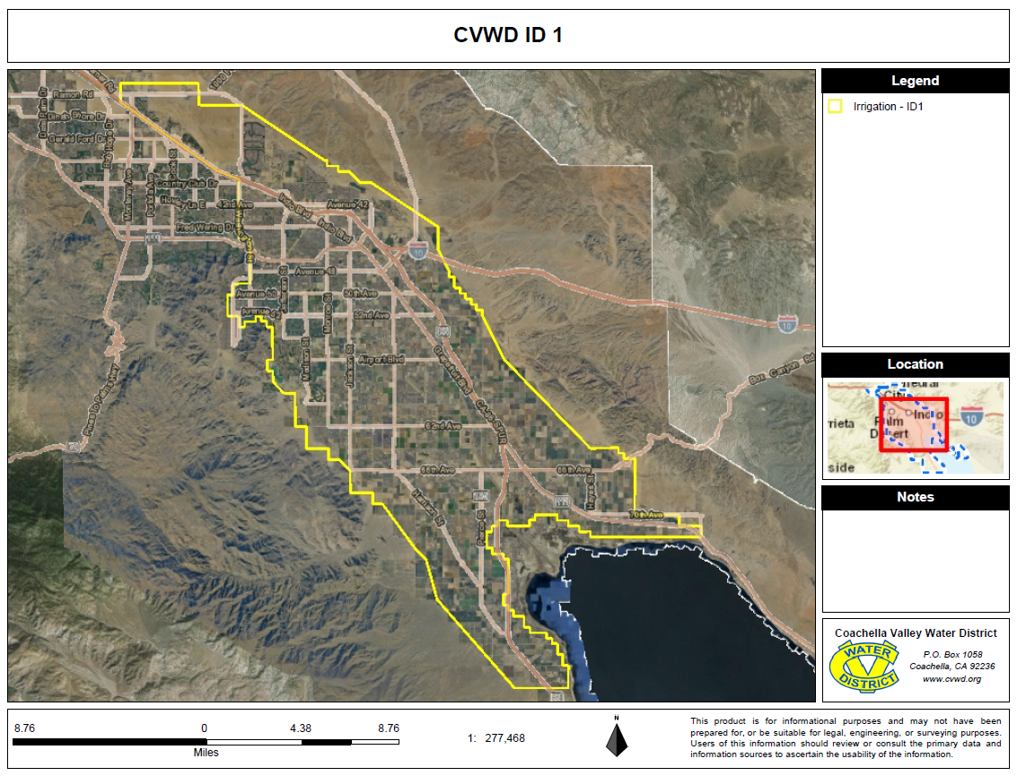
l. Large projects located outside Improvement District No. 1 of the Coachella Valley Water District shall connect to or provide future connection to recycled water if such water is available. Large projects located inside Improvement District No. 1 may be required to connect to canal irrigation water or recycled water if such water is available. (See attached boundary map.)
4. Drip Irrigation System Criteria.
a. The drip system must be sized for mature-size plants.
b. The irrigation system should complete all irrigation cycles during peak use in about 12 hours. Normally, each irrigation controller should not have more than four drip stations that operate simultaneously.
c. Field installed below ground pipe connections shall be threaded PVC or glued PVC. Surface laid hose and tubing is prohibited. Polyethylene tubing is allowed only in subsurface installations. Drip emitter installation shall be directly into polyethylene tubing on a one-quarter-inch thick walled riser. Multi-port outlet devices and multi-port distribution is prohibited.
d. Proportion gallons per day per plant according to plant size. The following sizing chart is for peak water use. The low to high end of the range is according to the relative water requirements of the plants. The low end is for desert natives and the high end is for medium water use type plants.
|
Size of Plant |
Gallons per Day |
|---|---|
|
Large trees (over 30-foot diameter) |
58+ to 97+ |
|
Medium trees (about 18-foot diameter) |
21 to 35 |
|
Small trees/large shrubs (9-foot diameter) |
6 to 10 |
|
Medium shrubs (3.5-foot diameter) |
0.8 to 1.3 |
|
Small shrubs/groundcover |
0.5 or less |
e. Plants with widely differing water requirements shall be valved separately. As an example, separate trees from small shrubs and cactus from other shrubs. Multiple emitter point sources of water for large shrubs and trees must provide continuous bands of moisture from the root ball out to the mature drip line plus 20 percent of the plant diameter. See Appendix C of this chapter for more information on emitter spacing and wetted area.
f. Most plants require 50 percent or more of the soil volume within the drip line to be wetted by the irrigation system. See Appendix C of this chapter for more information. For additional information on plant watering and plant relative water needs, see the plant list section of the “Lush and Efficient, Desert Friendly Landscaping in the Coachella Valley” or a list provided by the local agency.
5. Recycled Water Specifications.
a. When a site has recycled water available or is in an area that will have recycled water available as irrigation water, the irrigation system shall be installed using the industry standard purple colored or marked “Recycled Water Do Not Drink” on pipes, valves and sprinkler heads.
b. The backup groundwater supply (well water or domestic water) shall be metered. Backup supply water is only for emergencies when recycled water is not available.
c. Recycled water users must comply with all county, state and federal health regulations. Cross connection control shall require a six-inch air gap system or a reduced pressure backflow device. All retrofitted systems shall be dye tested before being put into service.
d. Where available, recycled water shall be used as a source for decorative water features.
e. Sites using recycled water are not exempted from the maximum applied water allowance (MAWA), prescribed water audits or the provisions of these criteria.
f. A recycled water checklist (Appendix G of this chapter) shall be submitted to the district upon submittal of the first plan check of the landscape design plan and the irrigation design plan.
6. Irrigation Water (Nonpotable) Specifications.
a. When a site is using nonpotable irrigation water that is not recycled water (from an on-site well or canal water) all hose bibs shall be loose key type and quick coupler valves shall be of locking type with nonpotable markings to prevent possible accidental drinking of this water.
b. Sites using nonpotable irrigation water are not exempted from the maximum applied water allowance (MAWA), prescribed water audits or the provisions of these criteria.
7. Groundwater Water Specifications.
a. Sites using groundwater irrigation water from wells are not exempted from the maximum applied water allowance (MAWA), prescribed water audits, or the provisions of these criteria.
8. Golf Course Criteria.
a. For all new golf courses and additions or renovations to existing golf courses, the area of irrigated turf used for tees, fairways, greens and practice areas shall be limited. The total turf area of the golf course shall be limited to a maximum of four irrigated acres average per golf hole. Practice areas such as driving ranges and short game areas shall not exceed 10 acres of turf. The golf course design shall reflect the natural topography and drainage ways of the site, minimize the clearing of vegetation and be flexible and water efficient in design.
b. All nonturf areas such as ponds, lakes, artificial water courses, bunkers and irrigated landscapes within the golf course project area must not exceed the maximum applied water allowance (MAWA) calculations set forth within these criteria. (Ord. 1302.5, 2020; Ord. 1302.4 Att. A, 2019; Ord. 1302.3 Att. A, 2017; Ord. 1302, 2003)